
Comite Resources has conducted wetland delineations throughout Louisiana for over a decade. A delineation includes assessment of vegetation, soils and hydrology, with expertise in these areas critical to the success of any project. Field biologists with Comite Resources are trained in wetland delineation methods and they have extensive experience in identifying wetland plant indicators, hydric soils criteria, and indicators of wetland hydrology. Wetland delineations are carried out under the direction of Mr. Jason Day, a Society of Wetland Scientists certified Professional Wetland Scientist (#3341), Wetland Delineator, Recertified 2/16/2021. Below are examples of several wetland delineations that Comite Resources has carried out.

Lacombe Trace Trails & Nature Park Wetland Delineation
Comite Resources personnel carried out a wetland delineation of the planned Lacombe Trace Trails & Nature Park at Lacombe, LA. The project site is approximately an equilateral triangle with sides of ∼1700 ft, totaling ∼26 acres. The planned nature park will have limestone walking trails, picnic pavilions, a kayak launch, and a fishing boardwalk. Comite Resources was able to distinguish between jurisdictional and non jurisdictional wetlands in the planned park, which aided in the final design. The delineation was submitted and accepted by the Corps of Engineers, allowing our client to move forward with their project.
Tchefuncte West Bank Marsh Creation Project Wetland Delineation
Comite Resources personnel carried out a wetland delineation of the planned Tchefuncte West Bank Marsh Creation Project in the fall of 2022. The project site was located on the west bank of the mouth of the Tchefuncte River and was mostly open water transitioning to wetlands to the north with an approximate area of 120 acres. Comite Resources was able to determine areas where the staging of materials could occur without impacting wetlands, which greatly aided the project. The delineation was submitted and accepted by the Corps of Engineers, allowing our client to move forward with the project.


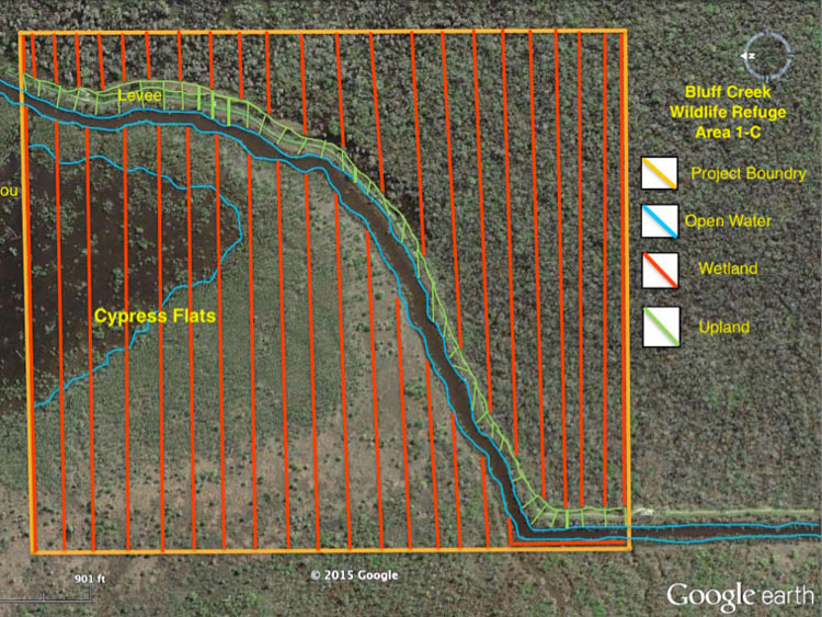
Bluff Swamp Wildlife Reserve
Comite Resources delineated the wetland boundary of the Bluff Swamp Wildlife Reserve (BSWR) located at the intersection of Iberville, Ascension and East Baton Rouge Parishes, Louisiana. In this mostly overlooked wetland are several hundred giant cypress trees of over 700 years old. Frank Bonifay and Jim Ragland, proprietors of the nonprofit BSWR, have no idea how the giant trees survived, but suspect it was due to difficulty in accessing the area. Comite Resources conducted a wetland delineation of the area, providing the BSWR the documentation it needed to pursue legal protection of the region.
Jonathan Davis Wastewater Treatment Plant
Comite Resources delineated the wetlands in the location where a new wastewater treatment plant is planned in Jefferson Parish. Positive wetland hydrology, vegetation, and soils were found throughout the project area, and a boundary line was identified demarcating upland from wetland. Comite Resources provided a wetland delineation report to the Parish, with maps and supporting documentation, so that it could proceed with construction of the new wastewater treatment plant.

Pipeline Right of Way for the City of Kenner
In 2012 Comite Resources carried out a wetland delineation on a 10,600 ft pipeline corridor for the city of Kenner. The 8,100-hectare LaBranche wetlands of St. Charles Parish consisted primarily of non-regenerating baldcypress-water tupelo and freshwater herbaceous wetlands in the southern convex ridge of the natural levee, grading to intermediate, brackish, and saline marsh and shallow open water ponds closer to Lake Pontchartrain. Comite Resources provided the city of Kenner with maps and supporting documentation so that it could proceed with construction of the new pipeline.
Lutcher Assimilation Wetlands
Comite Resources carried out a wetland delineation for the implementation of a wetland assimilation project adjacent to the Lutcher wastewater treatment plant. The project area is approximately 570 acres of cypress-tupelo forested wetlands. Comite Resources provided the town of Lutcher with maps and supporting documentation so that it could apply for permits to discharge treated municipal effluent to the wetland.
South Vacherie Assimilation Wetlands
Comite Resources delineated wetland boundaries for implementation of a wetland assimilation project in St. James Parish. The project area was approximately 2,600 acres of baldcypress-water tupelo forested wetlands located east of Highway 20 between Vacherie and Thibodaux, Louisiana. The entire project area was designated as wetlands, as detailed in the final wetland delineation report that Comite Resources provided to the city of Vacherie and the project is currently under construction.