
Understanding the Benefits & Design of Constructed Wetlands In a previous discussion titled “What is a wetland?“, we explore the multifaceted roles of natural wetlands. They are crucial for supporting diverse plant and animal species, controlling floods by absorbing surplus water, enhancing water quality through the removal of pollutants, and preserving biodiversity. Recognizing these benefits, constructed wetlands are specially engineered to treat various types of waste- and stormwater. They remove nutrients, sediments, heavy metals, and other contaminants, offering a sustainable and cost-effective alternative to traditional water treatment methods. Constructed wetlands are a cost-effective alternative to conventional treatment facilities, with lower construction and maintenance costs and adaptability to fluctuating water levels. Additionally, the vegetation in these wetlands not only beautifies the landscape but also reduces unpleasant odors typically associated with wastewater treatment facilities. Key Components of Constructed Wetlands Core components of constructed wetlands are similar to their natural counterparts, comprising of …
Continue reading “Understanding the Benefits & Design of Constructed Wetlands”

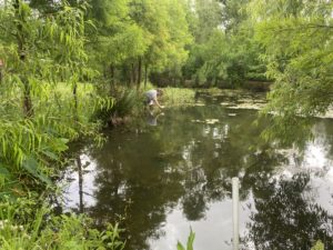
Wetland elevation dynamics hinge on the intricate interplay between subsidence and accretion processes. Subsidence includes several local factors that contribute to the gradual lowering of wetland elevation such as compaction and consolidation of sediments, occurring both in shallow and deep layers, tectonic activity influencing the geological framework, and human-induced impacts like the withdrawal of oil and gas. These various elements collectively shape the subsidence profile of a wetland, highlighting the dynamic nature of the landscape. Accretion, Subsidence and Sea Level Rise Conversely, accretion denotes the vertical buildup of soil on the wetland surface, a measurable phenomenon often tracked using markers like feldspar. This accumulation process plays a pivotal role in maintaining wetland elevation and countering the effects of subsidence. The combination of eustatic sea-level rise and subsidence is encapsulated in the concept of Relative Sea-Level Rise (RSLR), a critical metric for understanding the overall changes in wetland elevation over time. …
Continue reading “Why rSETs are Important for Wetland Monitoring”

What is a Wetland Delineation? A wetland delineation determines the boundary between uplands and wetlands on a property following guidelines established by the United States Army Corps of Engineers (USACE). It involves identifying, characterizing, and mapping wetlands based on soil, vegetation and hydrologic characteristics. The process of delineation involves a combination of fieldwork, data analysis, and consultation with regulatory agencies. In the field, a skilled wetland scientist evaluates the site’s characteristics for key indicators such as wetland hydrology, hydric soils and hydrophytic vegetation, which define wetland ecosystems (See “What is a Wetland?“). These findings are then meticulously mapped and documented to delineate the precise boundaries of the wetlands on the property. Why Do I Need a Wetland Delineation? Because of their benefits (e.g., habitat, water quality improvement, stormwater storage, carbon sequestration), wetlands are important and regulated ecosystems in the United States. The U.S. Environmental Protection Agency (EPA) generates and enforces …
A Phase 1 Environmental Site Assessment (ESA) is a critical and standard practice in real estate transactions, particularly when purchasing or financing commercial properties. This assessment plays a crucial role in identifying potential environmental liabilities associated with a property, offering invaluable insights for all parties involved in the transaction. The key reasons that that a Phase 1 ESA might be needed include: Securing Financing Regulatory Compliance Shield Against Liability Risk Management One of the primary reasons for undertaking a Phase 1 ESA is its often-mandatory requirement for securing financing from lending institutions. Banks and financial entities seek assurance that the property being invested in doesn’t harbor hidden environmental issues that could translate into financial risks down the road. By initiating a Phase 1 ESA early in the due diligence process, potential environmental concerns can be unearthed, allowing for well-informed decision-making by all involved parties. The Phase 1 ESA serves as …
Continue reading “Why Do I need a Phase 1 Environmental Site Assessment?”

Requiring a permit to build on jurisdictional wetlands is a crucial aspect of environmental conservation and sustainable land use management. Wetlands play a vital role in maintaining ecological balance, providing habitat for diverse plant and animal species, improving water quality, and offering flood control. The need for a permit stems from the recognition that unregulated development in these sensitive areas can have significant and often irreversible impacts on the environment. In this blog post, we’ll delve into the why behind the need for permits and how they serve as guardians of these vital natural landscapes. Ecological Importance of Wetlands: Before we explore the intricacies of permits, it’s essential to understand why wetlands merit such stringent regulatory measures. Wetlands contribute significantly to ecological balance—they provide habitats for diverse plant and animal species, enhance water quality, and act as effective flood control mechanisms. Recognizing their irreplaceable role in the environment, various local, …
Continue reading “Why Do I need a Permit to Build on Wetlands?”
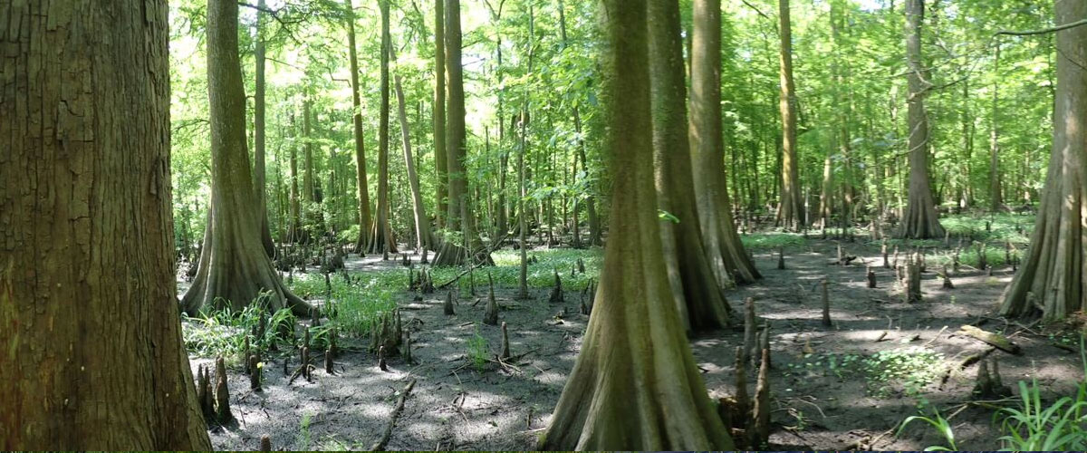
A wetland is an area where water is present either on the soil surface or within the plant root zone for a portion of the year and contains vegetation adapted to wet soils. Wetlands are diverse ecosystems that bridge the gap between terrestrial and aquatic environments. They’re incredibly important because they provide habitat for a wide variety of plant and animal species, help control flooding by absorbing excess water, improve water quality by removing pollutants such as excess nutrients, and help maintain biodiversity. Wetlands include marshes, swamps, bogs, and areas along water bodies such as bayous or lakes. Wetlands dominated by trees are called swamps and wetlands dominated by herbaceous (i.e., non-woody plants) plants are called marshes. Wetland vegetation species distribution is determined by hydrology, specifically length and depth of soil surface flooding. A typical wetland will emerge from an adjacent water body into the shallow aquatic zone where floating …