
What is a Wetland Delineation?
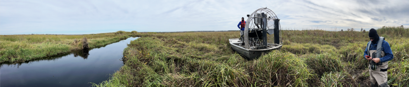
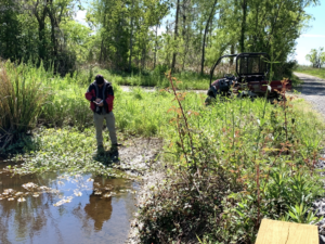
A wetland delineation determines the boundary between uplands and wetlands on a property following guidelines established by the United States Army Corps of Engineers (USACE). It involves identifying, characterizing, and mapping wetlands based on soil, vegetation and hydrologic characteristics. The process of delineation involves a combination of fieldwork, data analysis, and consultation with regulatory agencies. In the field, a skilled wetland scientist evaluates the site’s characteristics for key indicators such as wetland hydrology, hydric soils and hydrophytic vegetation, which define wetland ecosystems (See “What is a Wetland?”). These findings are then meticulously mapped and documented to delineate the precise boundaries of the wetlands on the property.
Why Do I Need a Wetland Delineation?
Because of their benefits (e.g., habitat, water quality improvement, stormwater storage, carbon sequestration), wetlands are important and regulated ecosystems in the United States. The U.S. Environmental Protection Agency (EPA) generates and enforces policies that avoide or minimize adverse impacts to wetlands when possible. A wetland delineation is needed whenever there is a potential impact on wetland areas due to land development projects. By identifying and mapping wetland boundaries accurately, stakeholders can make informed decisions that prioritize the conservation and sustainable use of these vital ecosystems.
A wetland delineation is also necessary if an activity negatively impacts a wetland to determine the amount of “compensatory mitigation” needed. Compensatory mitigation could mean several things:
-
- Restoration: Re-establishing or rehabilitating a degraded wetland.
- Establishment: Creating a new wetland where one did not previously exist;
- Enhancement: Improving existing one or more wetland functions; or
- Preservation: Using legal and physical mechanisms to protect or enhance an existing, ecologically important wetland.
As a developer or project decision-maker, wetland delineation and its potential findings may appear daunting. Here are some common concerns and why they might be causing unnecessary worry:
- Limited Expertise: Wetland delineation demands specialized knowledge and skills. Collaborating with an experienced consultant can help alleviate uncertainties and ensure precise determination of wetland boundaries.
- Regulatory Complexity: The rules governing wetland delineation and permitting can be intricate and difficult to decipher. Partnering with a consultant well-versed in regulatory compliance and environmental permitting is essential for success.
- Time Constraints: Tight project schedules can amplify the pressure. Recognizing the significance of meeting deadlines is crucial, along with harnessing cutting-edge technology and tools to enhance efficiency and accuracy.
- Cost Considerations: Wetland delineation may seem like an added expense, particularly for larger projects. However, investing in this process upfront can prevent substantial costs and complications later on if a wetland that was not known about is disturbed during construction.
- Potential for Disruptions: Delineations may reveal previously unidentified wetland boundaries, potentially causing delays or interruptions during permitting. Addressing these discoveries early is key to minimizing project disruptions.
The process of identifying and delineating wetlands is complex. Contact Comite Resources, an environmental consulting company with a knowledgeable and experienced staff, to provide expertise and support throughout the entire process.