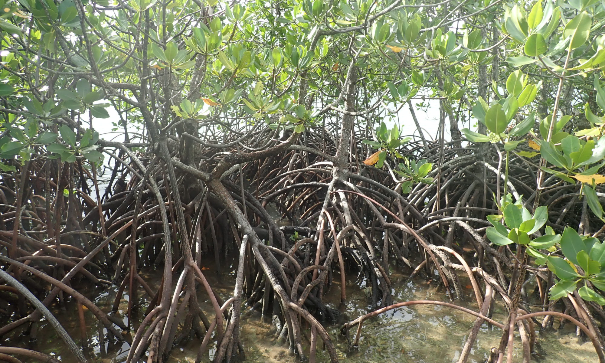
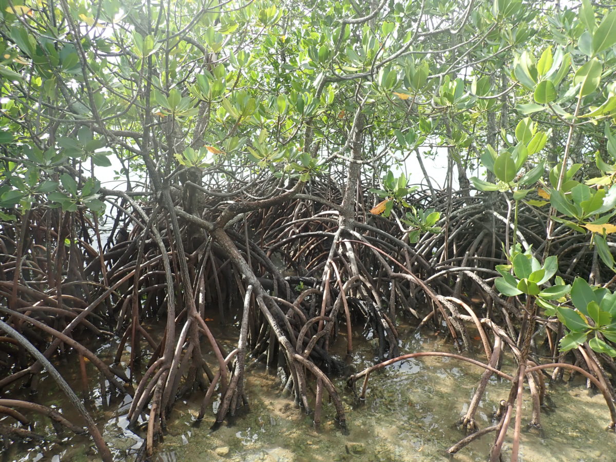
Mangrove community (Rhizophora mucronata) on Guam (December 2018).
Comite Resources has extensive experience working with mangroves in coastal Louisiana (see Carbon Sequestration) as well Mexico and the south Pacific. In particular, Comite Resources has developed a pilot mangrove restoration plan for the naval base at Guam. There has been significant losses of mangroves historically on Guam caused by the U.S. military, with an estimated 500 ha of land area filled to create the naval base. Guam’s coral reefs are an important component of the island’s tourism industry and the harbor near the naval base is a prime area for recreational diving. Comite Resources has developed a plan of mangrove forest rehabilitation for the mangrove communities surrounding the Guam naval base. The goal of the project is to restore sediment filtration capacity, which will improve water quality, increase juvenile fish refuge and foraging opportunities, and benefit nearby coral reefs.
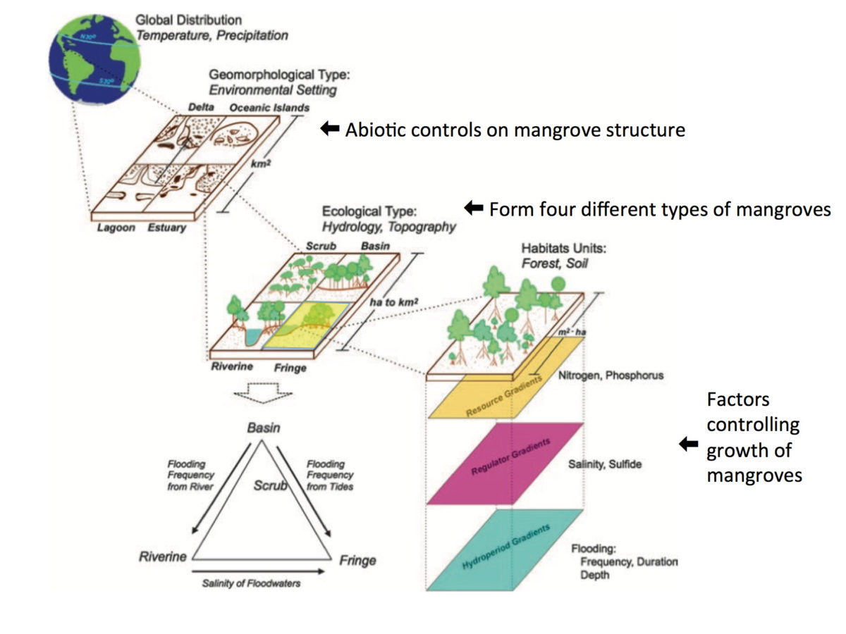
Hierarchical classification for mangrove-dominated ecosystems describing abiotic controls on mangrove structural and functional properties at the global, regional and local scale. Factors in each spatial level control processes defining soil properties, fertility gradients, and mangrove productivity (modified from Rivera-Monroy et al. 2017).
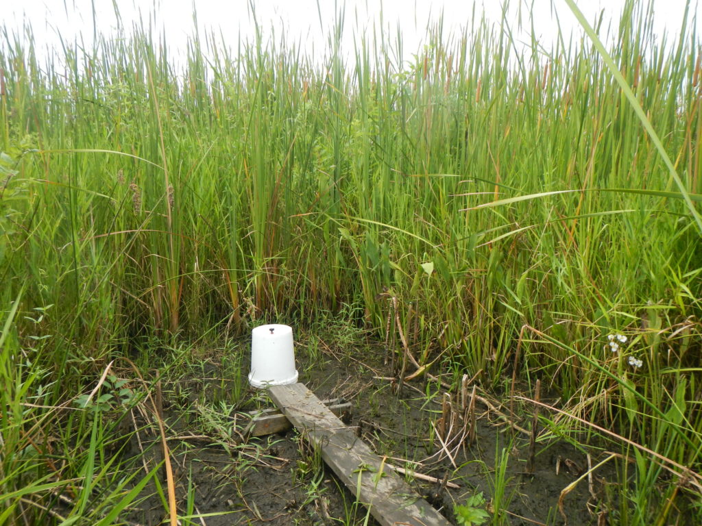
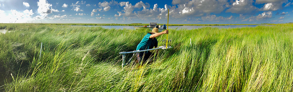
Surface Elevation and Accretion Data Gathering at Historical Plots in the Biloxi Marshes
In 2003, University of New Orleans researchers established 30 surface elevation table (SET) sites with accretion markers at the Biloxi marshes. As part of the effort to include the Biloxi wetlands in the Coastal Master Plan (see Biloxi Marshes), these sites are being re-visited to measure surface elevation and accretion. Comite Resources was charged with finding these historical sites to collect new data. Drs. Day and Lane of Comite Resources have extensive experience installing and measuring SETs and accretion (Day et al. 1998, 1999; Lane et al. 2006). Contact us for help installing new SET plots or for measuring historical sites if available.
SET measurements being taken at the Biloxi marshes on October 2, 2018.
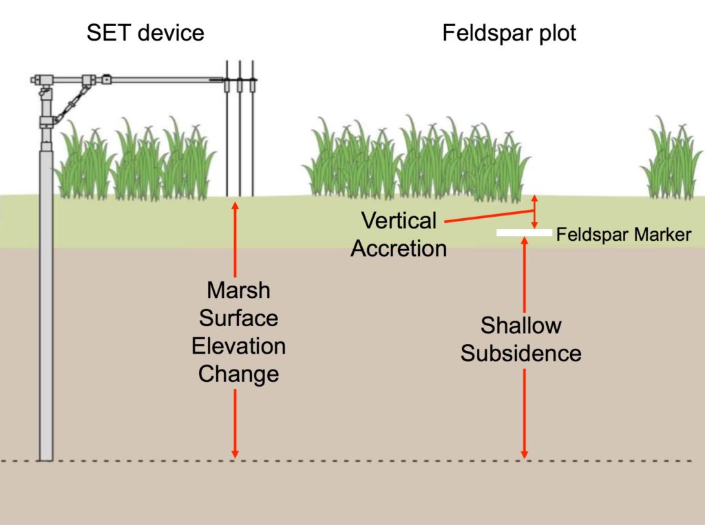
What is a surface elevation table (SET)?
Each SET consists of a base support pipe driven 4-6 m into the marsh that is fitted with a second portable section. The portable part of the SET is a precisely machined device that can be leveled to the exact same position during every measurement, providing a constant reference plane from which to measure the distance to the sediment surface.
What does this tell us?
Using the SET device in conjunction with feldspar markers provides information regarding changes in wetland surface elevation and accretion. The difference between these two measurements is shallow subsidence, which accounts for a majority of subsidence in coastal Louisiana compared to deep subsidence. Subsidence is one of the fundamental factors controlling the overall health and sustainability of a given wetland.
Schematic of a surface elevation table (SET) and feldspar marker plot showing the relationships between marsh surface elevation change, shallow subsidence and accretion.
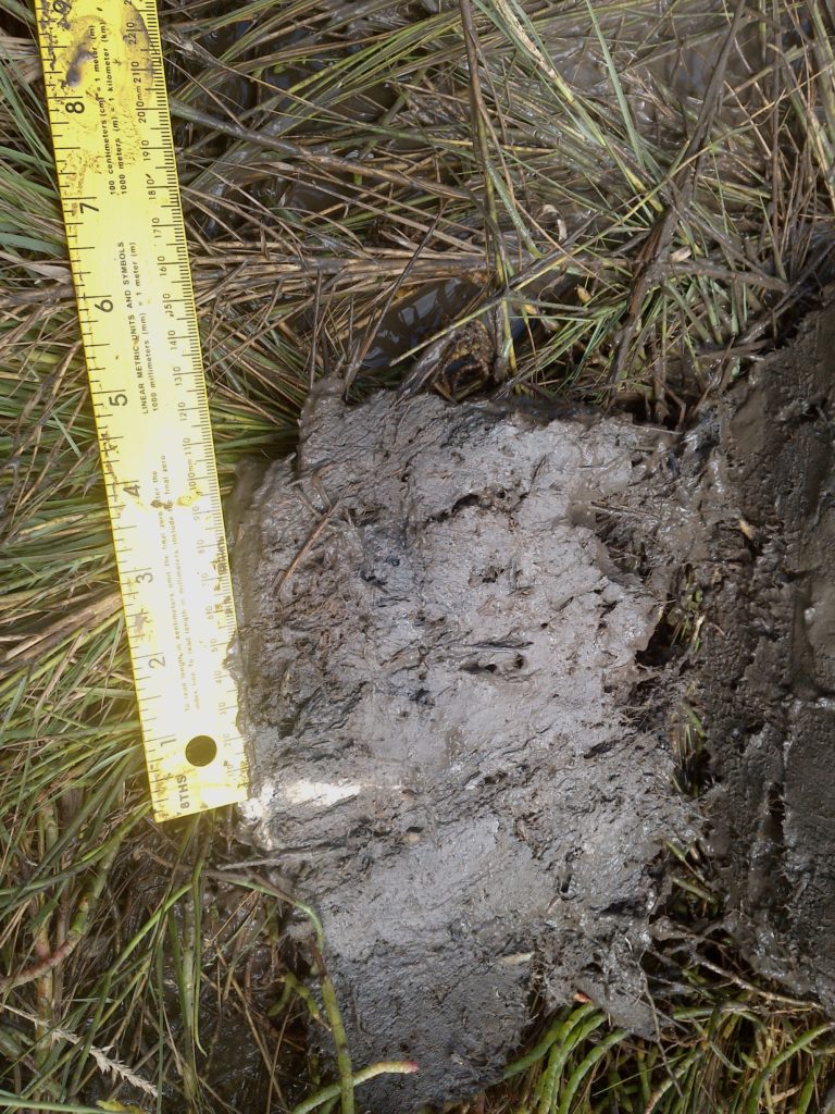
Over 11 cm (4.3 inches) of accretion over a feldspar plot that was deployed in 2003. The base of the ruler is at the feldspar plot and the material above is accretion.
Comite Resources has conducted wetland delineations throughout Louisiana for over a decade. A delineation includes assessment of vegetation, soils and hydrology, with expertise in these areas critical to the success of any project. Field biologists with Comite Resources are trained in wetland delineation methods and they have extensive experience in identifying wetland plant indicators, hydric soils criteria, and indicators of wetland hydrology. Wetland delineations are carried out under the direction of Mr. Jason Day, a Society of Wetland Scientists certified Professional Wetland Scientist (#3341), Wetland Delineator, Recertified 2/16/2021. Below are examples of several wetland delineations that Comite Resources has carried out.
Lacombe Trace Trails & Nature Park Wetland Delineation
Comite Resources personnel carried out a wetland delineation of the planned Lacombe Trace Trails & Nature Park at Lacombe, LA. The project site is approximately an equilateral triangle with sides of ∼1700 ft, totaling ∼26 acres. The planned nature park will have limestone walking trails, picnic pavilions, a kayak launch, and a fishing boardwalk. Comite Resources was able to distinguish between jurisdictional and non jurisdictional wetlands in the planned park, which aided in the final design. The delineation was submitted and accepted by the Corps of Engineers, allowing our client to move forward with their project.
Tchefuncte West Bank Marsh Creation Project Wetland Delineation
Comite Resources personnel carried out a wetland delineation of the planned Tchefuncte West Bank Marsh Creation Project in the fall of 2022. The project site was located on the west bank of the mouth of the Tchefuncte River and was mostly open water transitioning to wetlands to the north with an approximate area of 120 acres. Comite Resources was able to determine areas where the staging of materials could occur without impacting wetlands, which greatly aided the project. The delineation was submitted and accepted by the Corps of Engineers, allowing our client to move forward with the project.
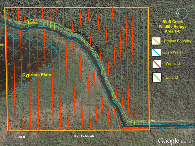
Delineation project boundary for the Bluff Swamp Wildlife Reserve
Bluff Swamp Wildlife Reserve
Comite Resources delineated the wetland boundary of the Bluff Swamp Wildlife Reserve (BSWR) located at the intersection of Iberville, Ascension and East Baton Rouge Parishes, Louisiana. In this mostly overlooked wetland are several hundred giant cypress trees of over 700 years old. Frank Bonifay and Jim Ragland, proprietors of the nonprofit BSWR, have no idea how the giant trees survived, but suspect it was due to difficulty in accessing the area. Comite Resources conducted a wetland delineation of the area, providing the BSWR the documentation it needed to pursue legal protection of the region.
Jonathan Davis Wastewater Treatment Plant
Comite Resources delineated the wetlands in the location where a new wastewater treatment plant is planned in Jefferson Parish. Positive wetland hydrology, vegetation, and soils were found throughout the project area, and a boundary line was identified demarcating upland from wetland. Comite Resources provided a wetland delineation report to the Parish, with maps and supporting documentation, so that it could proceed with construction of the new wastewater treatment plant.
Delineation project boundary for the Jonathan Davis wastewater treatment plant
Pipeline Right of Way for the City of Kenner
In 2012 Comite Resources carried out a wetland delineation on a 10,600 ft pipeline corridor for the city of Kenner. The 8,100-hectare LaBranche wetlands of St. Charles Parish consisted primarily of non-regenerating baldcypress-water tupelo and freshwater herbaceous wetlands in the southern convex ridge of the natural levee, grading to intermediate, brackish, and saline marsh and shallow open water ponds closer to Lake Pontchartrain. Comite Resources provided the city of Kenner with maps and supporting documentation so that it could proceed with construction of the new pipeline.
Lutcher Assimilation Wetlands
Comite Resources carried out a wetland delineation for the implementation of a wetland assimilation project adjacent to the Lutcher wastewater treatment plant. The project area is approximately 570 acres of cypress-tupelo forested wetlands. Comite Resources provided the town of Lutcher with maps and supporting documentation so that it could apply for permits to discharge treated municipal effluent to the wetland.
South Vacherie Assimilation Wetlands
Comite Resources delineated wetland boundaries for implementation of a wetland assimilation project in St. James Parish. The project area was approximately 2,600 acres of baldcypress-water tupelo forested wetlands located east of Highway 20 between Vacherie and Thibodaux, Louisiana. The entire project area was designated as wetlands, as detailed in the final wetland delineation report that Comite Resources provided to the city of Vacherie and the project is currently under construction.
Stormwater Wetlands
Urban development over the last several decades in the United States has greatly increased the extent of impervious surfaces, such as streets, rooftops, and parking lots in urban and suburban environs. Rainwater from these areas is often contaminated with pollutants, such as motor oil, gasoline, heavy metals, and fecal matter. And since rainwater cannot soak into the soil, impervious surfaces also generate greater volumes of runoff than natural areas, leading to increased frequency and depth of flooding (see Lane et al. 2015a). The use of stormwater wetlands solves both of these issues by holding water during storms, much like a retention basin, while also reducing pollutant concentrations in the water column. Below are several stormwater wetland projects that Comite Resources has assisted with in design and monitoring.
Sankofa Wetland Park
The Sankofa Wetland Park is located along the northern boundary of the 9 th Ward in New Orleans. The wetland park is approximately 200 ft wide and over a mile long, encompassing approximately 40 acres, with a linear pond situated along the entire length. The linear pond has direct connection to the St. Bernard drainage system and retains runoff during storm events. In addition to providing stormwater storage, the wetland park provides habitat for numerous birds, amphibians, reptiles, fish and other wildlife. The Sankofa Wetland Park is a much appreciated amenity to an otherwise impoverished neighborhood, and provides a peaceful and tranquil space for residents to picnic, fish, meditate and enjoy.
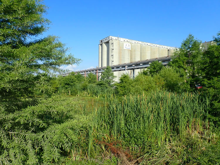
CHS
The south pond stormwater wetlands at CHS, inc.
CHS, Inc. is a bulk grain transfer terminal located south of Myrtle Grove, LA directly on the west bank of the Mississippi River. During rainfalls, grain dust from the facility washed into drainage ditches where total organic carbon (TOC) concentrations regularly exceeded the LPDES permit limit of 50 mg/L. In an effort to reduce TOC concentrations from the stormwater runoff, CHS implemented aggressive stormwater management practices and regular cleaning of earthen swales and other areas. Despite these changes, TOC concentrations continued to exceed permitted concentrations.
In response, Comite Resources designed and directed construction of two ~2-acre stormwater wetlands directly north and south of the facility. Several hundred baldcypress seedlings were planted along the edge of the ponds and weirs were installed to control water levels. Herbaceous wetland vegetation established itself naturally, and alligators and a large population of whistling ducks, along with other wildlife are also currently using the ponds.
Stormwater from the CHS facility is now routed through these wetlands prior to release into the local drainage network. Comite Resources monitors the wetlands for TOC reduction and vegetation growth and health. Influent TOC concentrations are at times as high as ~300 mg/L, but outflow effluent TOC concentrations are consistently below 40 mg/L, demonstrating that these wetlands are effectively reducing TOC concentrations of surface water runoff.
Highlights:
Project Management
Conceptual design of two stormwater wetlands
Vegetation planting
Vegetation and water quality monitoring
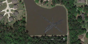
Del Sol
PVC structure of floating wetland at Del Sol as seen by Google Earth
Comite Resources partnered with St. Tammany Parish to develop, install and monitor a floating wetland to reduce nutrient and sediment concentrations of water flowing through the stormwater retention pond of the Del Sol subdivision in Covington, Louisiana. The floating wetlands were constructed using PVC with a mat constructed of vinyl-coated crab wire and planted with maidencane and other wetland vegetation such as southern swamp lily and southern blue flag iris. Approximately eighty baldcypress and fifty water tupelo seedlings were planted along the edge of the pond (survival rate >90%). Post-construction water quality monitoring showed that the floating wetland significantly reduced nitrogen and phosphorus concentrations of stormwater and improved water clarity over the course of the study. These reductions are proof-of-concept that constructed floating wetlands can be retrofitted into stormwater retention ponds for water quality improvement.
Highlights:
Design and construction of floating wetlands
Vegetation and water quality monitoring
Planting of baldcypress seedlings around the pond
Statistical analyses of data
Presentation of results at Del Sol Homeowners Association meetings
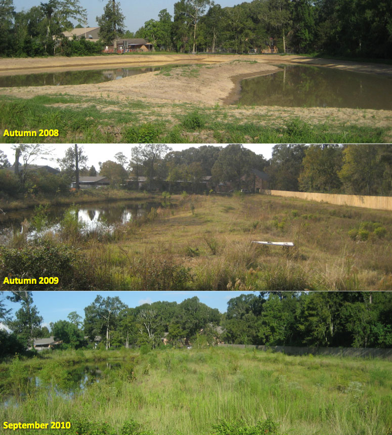
Woodlawn High School
As part of recent renovations, a wetland was constructed to decrease urban stormwater runoff from the parking lot of the Woodlawn High School (WHS) of the East Baton Rouge Parish School System. Originally a simple detention pond system, Comite Resources transformed it into a wetland to reduce the volume of stormwater runoff, increase residence time, uptake and sequester nutrients, and provide an educational training ground for schools. To create the wetland, our team constructed a meandering serpentine channel in the detention pond, planted wetland vegetation, and installed a weir drainage system at the far end of the detention pond to maintain a minimum water level within the created wetland. The meandering wetland channel was designed to be an aesthetically pleasing landscape feature as well as a functioning wetland filter, demonstrating the integration of landscape design with stormwater management and non-point source pollution mitigation.
Highlights:
Conceptual design of a stormwater wetland
Vegetation planting
Design of an irrigation system used during vegetation establishment
Vegetation and water quality monitoring
Development of the stormwater wetland at the Woodlawn High School
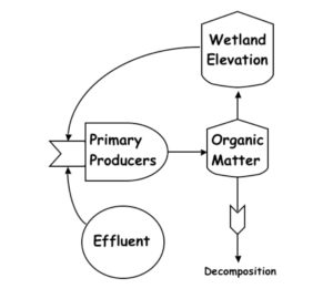
Assimilation wetlands are natural wetlands into which secondarily treated and disinfected effluent from a wastewater treatment plant is discharged to improve water quality and wetland sustainability. Nutrients in the municipal effluent increases wetland plant growth, and organic matter deposition on the wetland surface, which increases elevation and offsets subsidence and produces a positive feedback loop of increased ecosystem vigor and resiliency. Freshwater in the effluent provides a buffer against saltwater intrusion events, especially during drought. Thus, the introduction of treated municipal effluent into disturbed and isolated wetlands is a positive step towards their ecological restoration. This practice also benefits dischargers by reducing capital, operations, and maintenance costs compared to conventional wastewater treatment.
Conceptual model of the effects of effluent application to wetlands
Design and construction of an assimilation wetland typically requires a Louisiana Department of Natural Resources (LDNR) Coastal Use Permit (CUP), Louisiana Department of Environmental Quality (LDEQ) Louisiana Pollutant Discharge Elimination System (LPDES) permit, and US Army Corps of Engineers (USACE) 404 permit and Water Quality Standards certification, along with potential levee board permits, all of which Comite Resources has obtained for numerous projects.
Comite Resources works with municipalities to assess wastewater treatment needs and to identify potential wetland areas that would benefit from effluent discharge. Comite Resources collaborates with project engineers to design the effluent distribution pipeline and with LDEQ, LDNR, and USACE to secure permits. Comite Resources monitors assimilation wetlands serving the cities of Breaux Bridge, St. Martinville, Luling, Hammond and Mandeville and visits each wetland monthly to collect ecological data.
Highlights:
Conceptual design of assimilation wetland and effluent pipeline
Feasibility & ecological baseline studies
Monthly monitoring of vegetation, water quality, and hydrology
Preparation of LPDES, CUP, and 404 permit applications
Wetland delineation
Nutria management
The reference site at the Breaux Bridge assimilation wetlands
Breaux Bridge
During the late 1940’s the city of Breaux Bridge began discharging secondarily treated and disinfected municipal effluent into the Cypriere Perdue swamp, a 1,470-ha freshwater forested cypress-tupelo wetland located approximately one mile southwest of Breaux Bridge. In the late 1980’s the city received a compliance order from the USEPA and eventually an LPDES permit was issued in 1997 with BOD5 and TSS limits of 30 and 90 mg/L, respectively. The permit requires the City to monitor plant species composition, productivity, and metals concentrations, surface water nutrient and metals concentrations, soil accretion and metals concentrations, and hydrology of the assimilation wetland. Comite Resources has been monitoring this wetland and assisting the City in meeting its LPDES permit requirements since 2001.
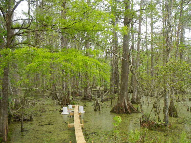
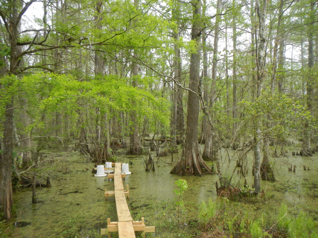
St. Martinville
The city of St. Martinville began discharging secondarily treated and disinfected municipal wastewater from the city’s 1.5 MGD treatment facility to the Cypress Island Coulee baldcypress- water tupelo swamp in 2011. The Cypress Island Coulee wetlands have been degraded by urbanization and conversion of surrounding areas to agriculture, and are characterized by over-drained soils and subsidence. Because these wetlands were used for rice and crawfish production, they consist of a number of shallow ponds separated by low levees. Treated effluent is discharged at six different locations around the south basin of the wetlands and surface water drains into the Cypress Island Coulee after flowing through the wetlands. Comite Resources handles all ecological monitoring required by the LPDES permit for the City.
Site 3M at the St. Martinville assimilation wetlands
The treatment boardwalk at the Luling assimilation wetlands
Luling
The city of Luling discharges secondarily treated and disinfected effluent into a 608-ha baldcypress-water tupelo swamp directly to the east of the wastewater treatment facility. The site is located within the Davis Crevasse, a large crevasse splay that was formed in the 19th century when the Mississippi River broke through the flood control levees and deposited sediments in an area of about 150 km2 (Day et al. 2016), forming the eastern boundary of the assimilation wetlands. Under natural conditions, water from the site where the oxidation pond is now located flowed in a southeasterly direction towards Lake Cataouatche. The dredging of Cousins Canal short-circuited surface water to flow directly to the lake, bypassing surrounding wetlands. The discharge of effluent from the treatment plant into these wetlands is a partial return to more normal water flow (Hunter et al. 2018). In 2014 Comite Resources measured carbon sinks and sources at the Luling assimilation wetlands and found the net difference between the Project (wetlands receiving effluent) and Baseline (no effluent) emissions was 11,617 mt CO2e/y (metric tons of CO2 equivalents per year; Lane et al. 2017). This study demonstrated the potential for using forested wetlands receiving treated municipal effluent for the net sequestration of carbon. Comite Resources has been actively monitoring the Luling assimilation wetlands to keep the City in compliance with its LPDES permit since 2005.
Hammond
During the fall of 2006, the city of Hammond began discharging secondarily treated and disinfected effluent into Four Mile Marsh located in the northwest corner of the Joyce wetlands (Lane et al. 2015b). The Hammond assimilation wetland has generated controversy because marsh deterioration occurred during the winter of 2007-2008, immediately following discharge of the effluent. Field observations and exclosure experiments indicated that the deterioration was due to herbivory by nutria (Shaffer et al. 2015). Others proposed that the deterioration was due to excessive inundation and nutrient induced decomposition, however, after nutria controls were put into place the vegetation in the assimilation wetlands began to recover, and it now mostly vegetated. Comite Resources visits this wetland monthly as part of LPDES permit requirements as well as for a marsh organ experiment with Dr. Gary Shaffer of Southeastern Louisiana University measuring the impact of rising sea level on plant growth.
Photo (top) of a fenced 2 x 2 m exclosure at the Hammond assimilation wetlands that prevented nutria entry established in 2008 after intense grazing over the fall and winter of 2007-2008, and another exclosure (bottom) during the Summer of 2011 after substantial recovery of marsh growth. The discharge pipe is located near the tree line in the background in the upper left of both photos.
The out site at the Mandeville-Tchefuncta assimilation wetlands
Mandeville
The city of Mandeville began discharging secondarily treated and disinfected municipal effluent into the Bayou Chinchuba assimilation wetland in 1998, but due to high loading rates a second assimilation wetland was established at the Tchefuncte Marsh. Effluent was then split between the two assimilation wetlands, and effluent discharged at this new location began in 2009. The wastewater treatment system includes three aerated lagoon cells, a three-celled rock reed filter, and an ultraviolet disinfection system. Comite Resources has been monitoring this wetland since 1998 and works closely with wastewater treatment personnel to maintain its rock reed filter and compliance with its LPDES permit.
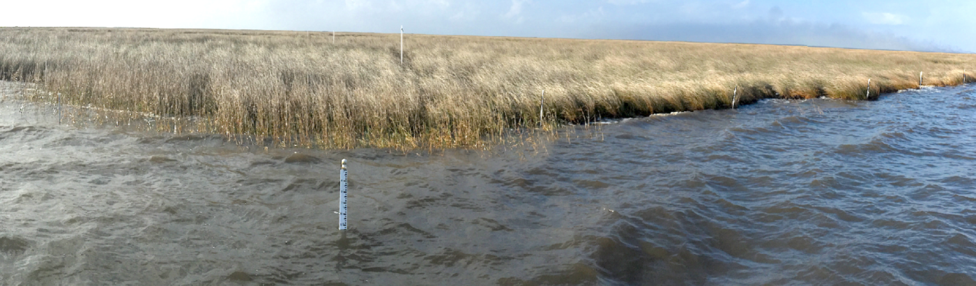
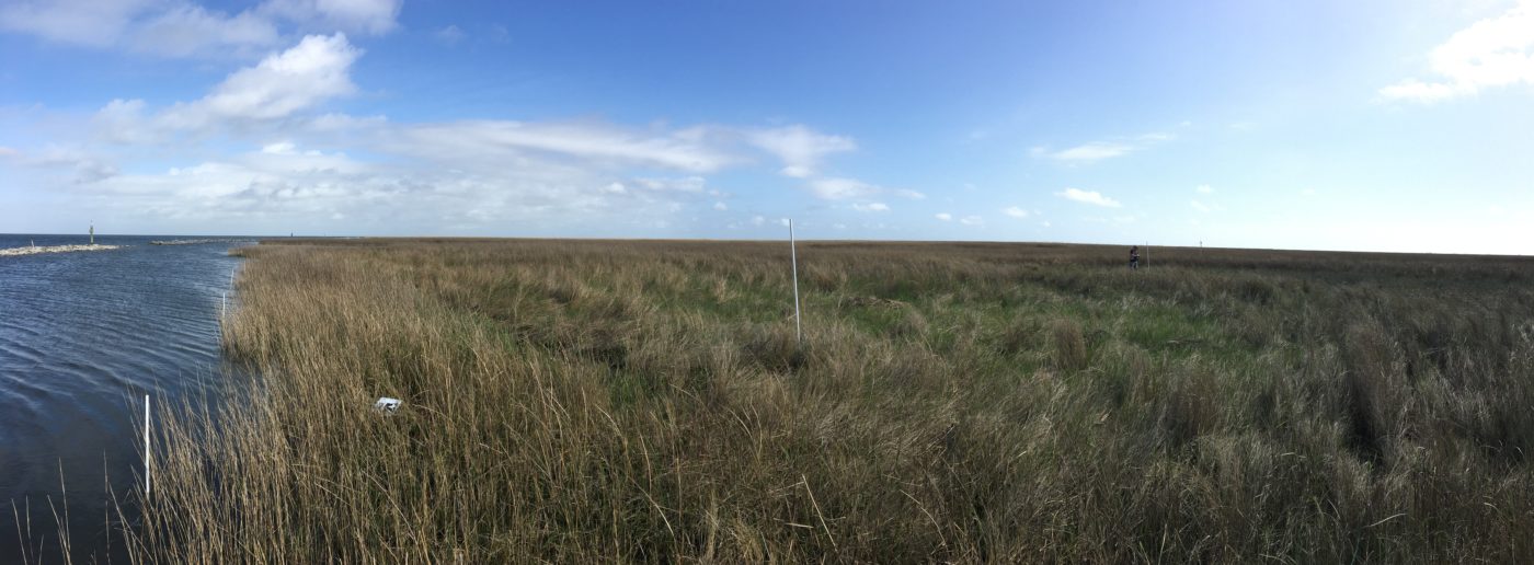
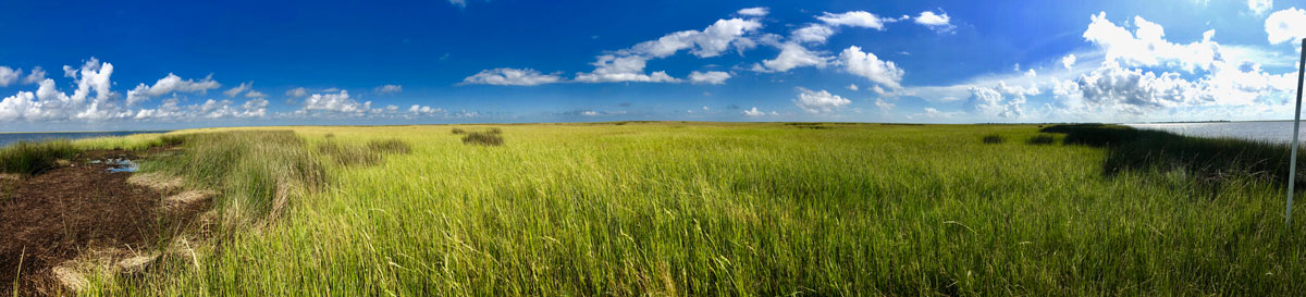
The Biloxi marshes are located southeast of New Orleans and consists of saline and brackish marshes that act as a storm barrier for the New Orleans-Slidell land bridge. In the absence of the Biloxi marshes, the land bridge and areas west, such as Lakes Pontchartrain and Maurepas, would transition from freshwater or intermediate to brackish or saline. Comite Resources is measuring shoreline edge erosion, wetland surface accretion, along with carrying out a water sampling program and instrumentation deployment. In addition, historical SET’s are being monitored at the interior of the wetland complex (see Sets at Biloxi Marshes).
These data will be combined with other historical data to persuade CPRA to include the Biloxi wetlands in the Coastal Master Plan, which currently has minimal resources devoted to the region. Comite Resources is proud to offer its services in this endeavor and is working closely with the Biloxi Land Corporation to assist in its goal of documenting the importance and relative sustainability of the Biloxi marsh complex.
Shoreline erosion and accretion plots on the southeastern shoreline of Lake Borgne. (March 2018).
Carbon sequestration refers to the removal of atmospheric carbon by plants and soils or other storage mechanisms, which can mitigate greenhouse gases released as a result of changes in land use and the burning of fossil fuels. Wetland restoration is an effective climate change mitigation strategy because it enhances carbon sequestration and avoids carbon releases that would occur in the absence of restoration activities. In the future, the ability to sell carbon credits may provide an important source of revenue for land-owners and project developers.
Comite Resources has quantified carbon sinks and sources at the Luling assimilation wetlands (Lane et al. 2017; see also Assimilation Wetlands). With Tierra Resources, the team measured carbon sequestered by trees and soils and emitted as greenhouse gases. We found that the net difference between the Project and Baseline emissions was 11,617 mt CO2e/y (metric tons of CO2 equivalents) if greenhouse gases were omitted and 49,505 mt CO2e/y if greenhouse gases were included. This study demonstrated the potential of using forested wetlands receiving treated municipal effluent for the net sequestration of carbon.
Greenhouse gas measurements taken using static gas chambers at the Luling assimilation wetlands
Greenhouse gas measurements taken at a freshwater emergent wetland with the vegetation removed
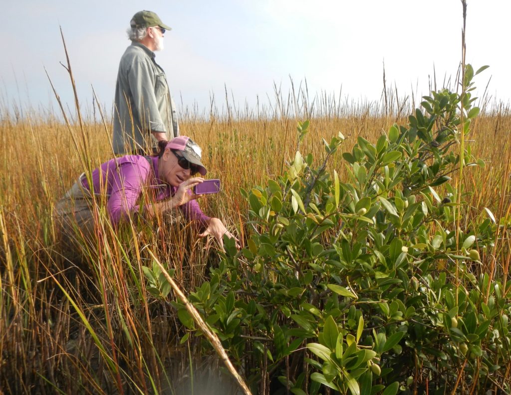
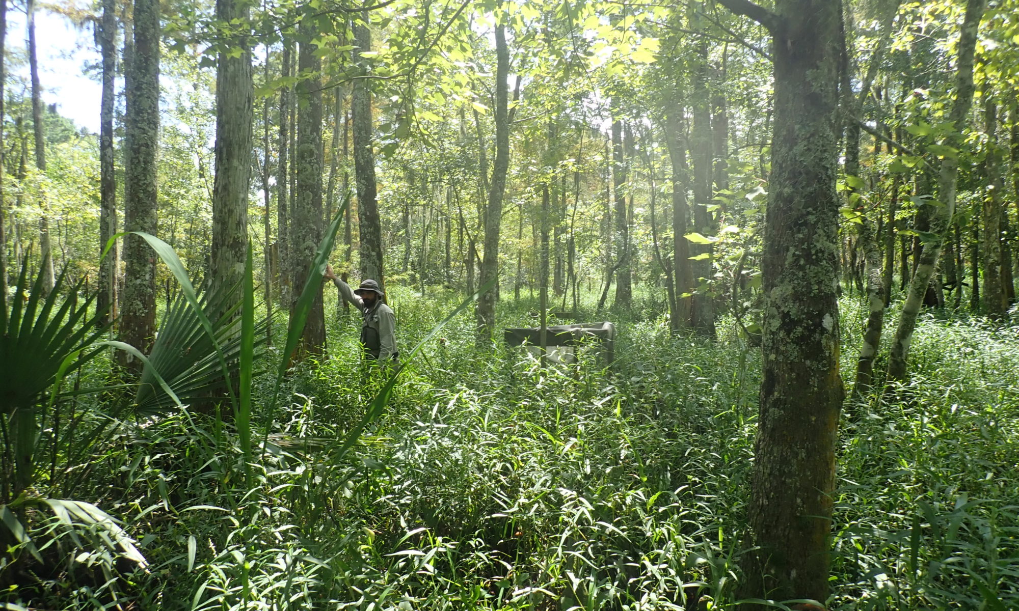
Comite Resources and Tierra Resources are also studying the use of mangrove plantings for sequestering carbon and increasing soil strength in coastal wetlands. Comite Resources planted over 6000 mangroves at 10 plots along the coast to assess their potential for coastal restoration. Results were mixed, but the potential for coastal restoration using a modified technique has been developed and is currently being tested (Tierra Resources).
Drs. Day and Mack examining a mangrove tree transplanted several years earlier


 The
The 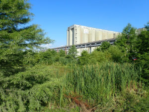
 Conceptual model of the effects of effluent application to wetlands